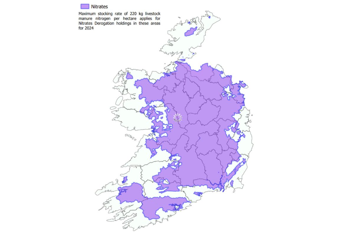
Final derogation map sees 6% reduction in area impacted

The updated map represents the removal of a small amount of land equating to 6% of the total area initially identified to move to 220kg/ha. A proportion of derogation farms will have lands in both the 250kg/ha area and the 220kg/ha areas and the limit on these farms will be calculated on a parcel-by-parcel basis and, where any part of the parcel is within the areas identified at the 250 kg limit, the whole parcel will be subject to this higher limit. The DAFM said it will be writing to derogation farmers in the coming weeks, to confirm the reduction from 250kg/ha to 220kg/ha and to provide any information relevant to the changes. Farmers are urged to engage with their agricultural advisors to review this data.
Commenting, Minister for Agriculture, Food and the Marine, Charlie McConalogue said: “My department and the Department of Housing, Local Government and Heritage have engaged actively, and the map reflects a modest decrease in the area impacted by the reduction in the maximum stocking rate, while abiding by the criteria laid down in the Commission’s implementing decision.” He said he recognised that this is a challenging outcome for some farmers. The final implementation map identifying areas that are subject to a reduction in limit in 2024 is published on the DAFM website.


